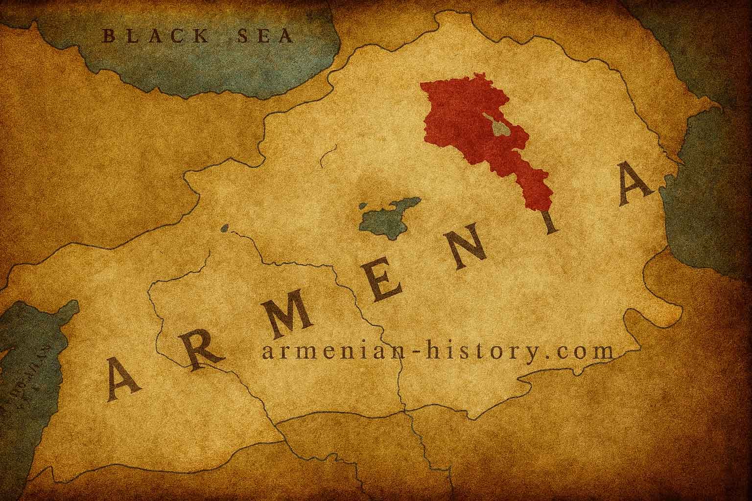
Historical Maps of Armenia (Ancient and Medieval)
Historical, demographic and political maps of Samtskhe-Javakhk
THE BABYLONIAN CLAY TABLET
6th c. BC
British Museum – London, Near Eastern
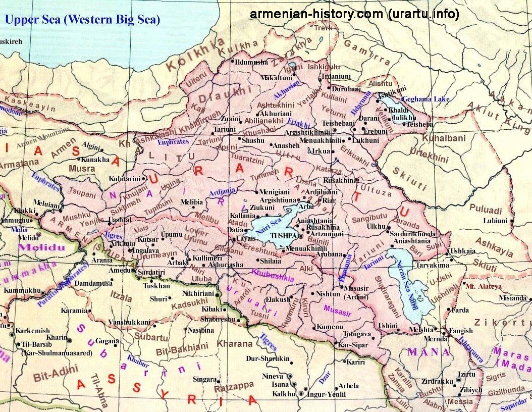
THE MAP OF THE KINGDOM OF URARTU
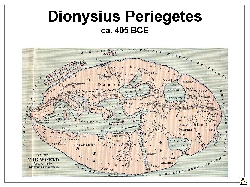
ANCIENT WORLD MAP 405 – created by Dionysius
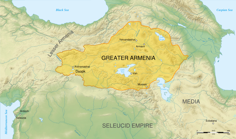
THE MAP OF ORONTID (YERVADUNI) ARMENIA – DURING 4-TH – 3-TH CENTURIES B.C.
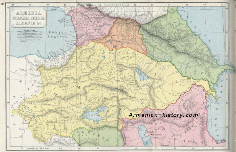
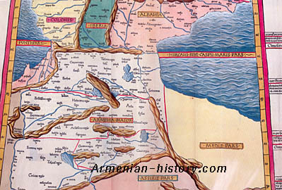
THE MAP OF ARMENIA, COLCHIS, IBERIA, ALBANIA
THE MAP OF ASIA MINOR
1482, Ulm, Germany, cartographer: Nicolaus Germanus
British Library – London
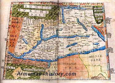
A MAP FROM PTOLEMY’S GEOGRAPHY
1482, Rome, Bononie edition,
British Library – London
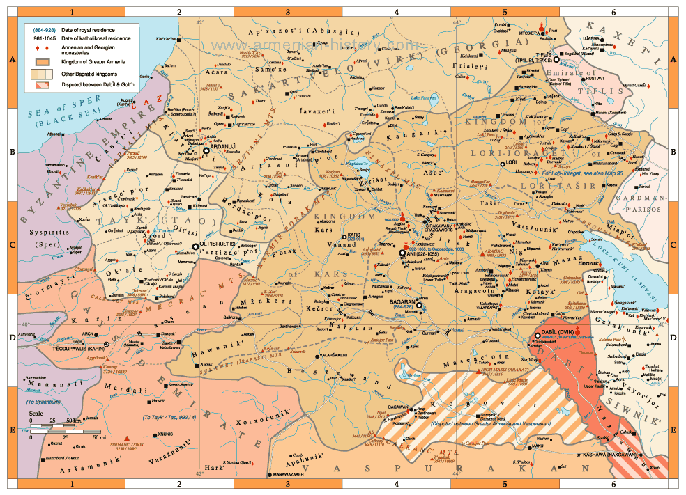
BAGRATID ARMENIA AND VASSAL KINGDOMS
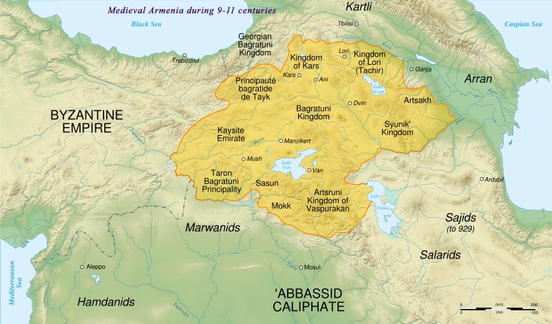
ARMENIAN KINGDOMS DURING 9TH-11TH CENTURIES
ARMENIA AND REGION (ASIA MINOR) IN 9TH-11TH CENTURIES
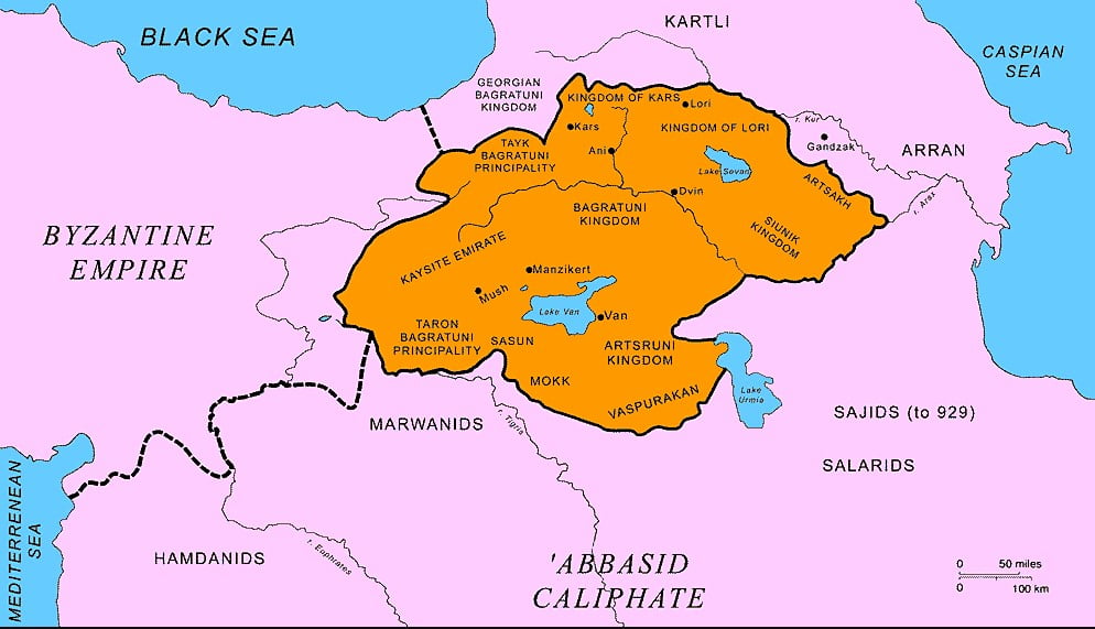
THE MAP OF MEDIEVAL ARMENIA – ARMENIAN KINGDOMS DURING 9TH-11TH CENTURIES
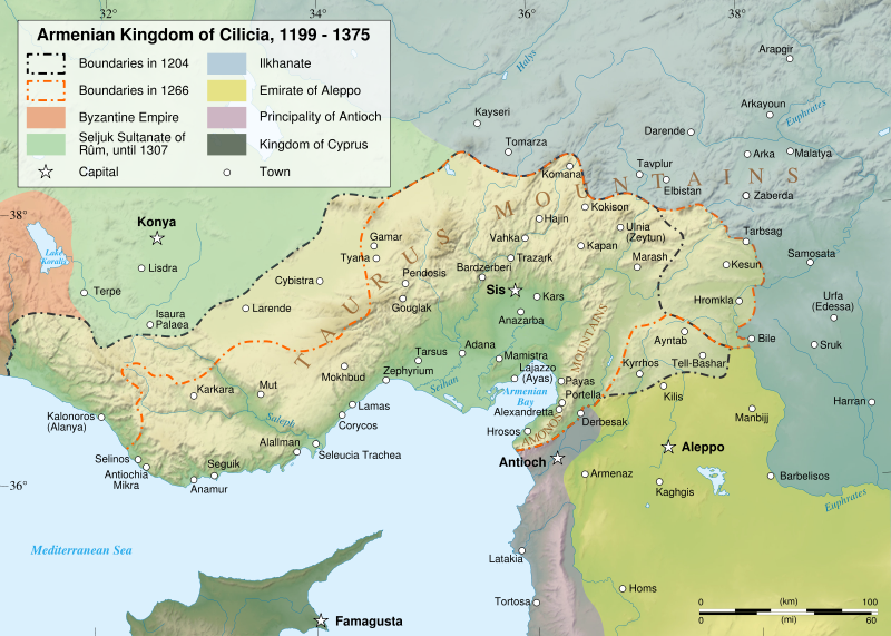
ARMENIAN KINGDOM OF CILICIA 1199-1375 NEW
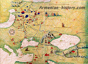
PORTOLAN MAP OF “RUSSIA, TARTARIA AND PART OF EUROPE AND ASIA” (DETAIL)
1553, cartographer: Battista Agnese
Museo Correr – Venice
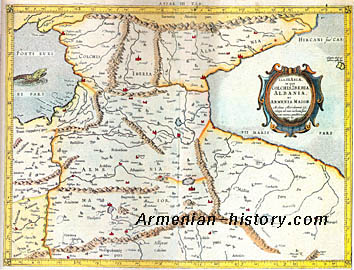
THE MAP OF “ARMENIA MAJOR, IBERIA, COLCHIS AND ALBANIA”
1605, cartographer: Jodocus Hondius
Private collection – London
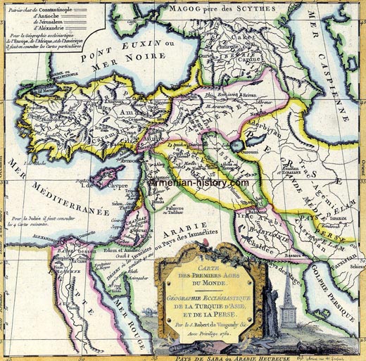
ARMENIA AND REGION, ROBERT DE VAUGONDY 1762
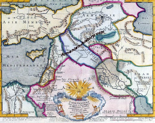
A GENERAL MAP FOR INFORMATION ABOUT THE HISTORY OF THE SAINTS”, PHILLIPPE BUACHE, PUBLISHED IN 1783 IN PARIS
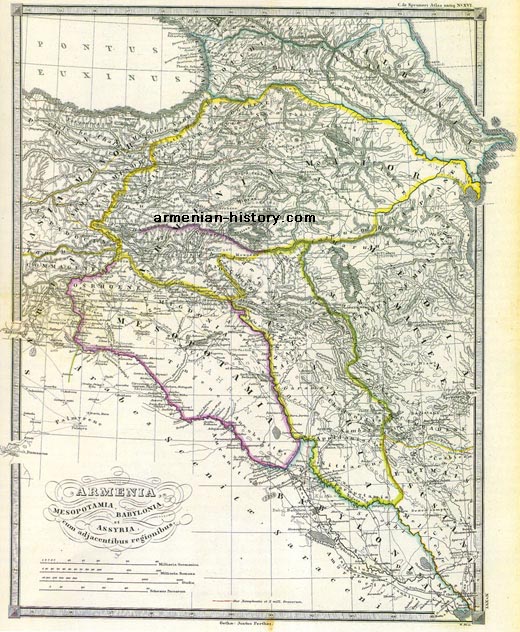
ARMENIA, MESOPOTAMIA, BABYLONIA AND ASSYRIA WITH ADJACENT REGIONS”, KARL VON SPRUNER, PUBLISHED IN 1865
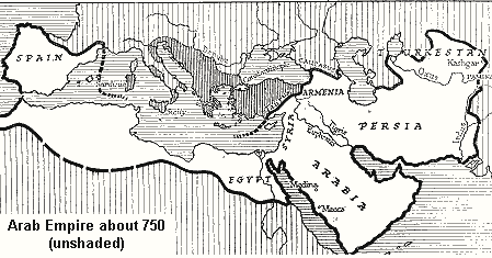
THE MAP OF ARAB CALIPHATE
Maps – Armenia 20th and 21 centuries
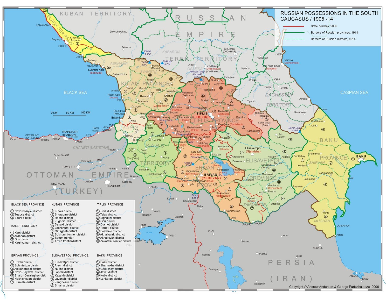
Administrative divisions of the South Caucasus (Transcaucasia) under the Russian Empire before 1914.
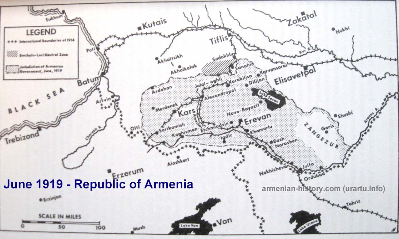
JUNE 1919 – FIRST REPUBLIC OF ARMENIA
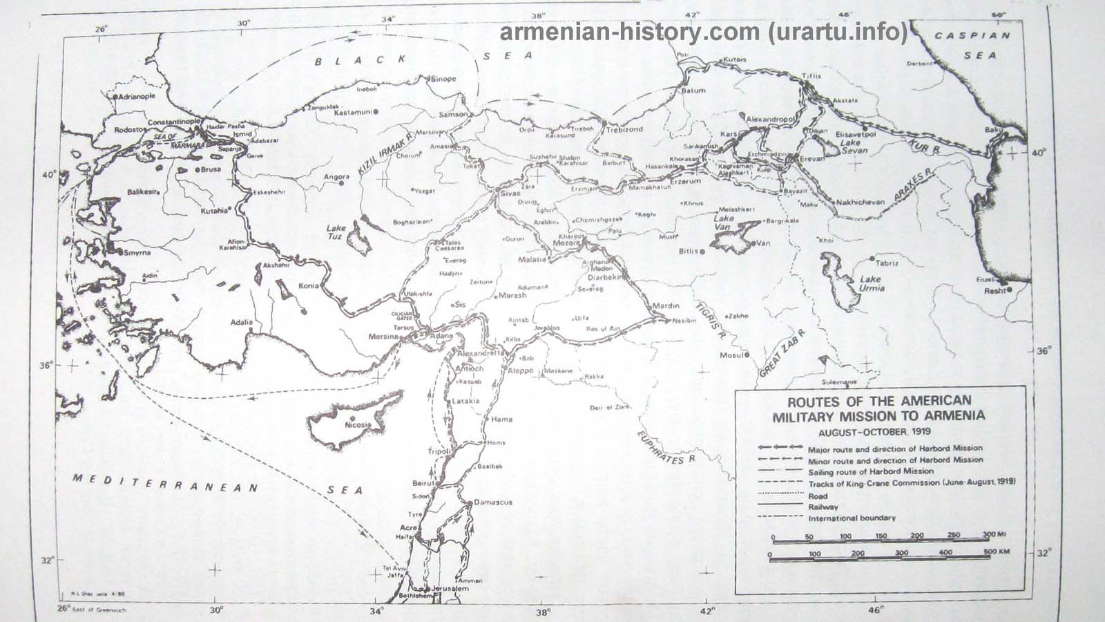
ROUTES OF THE AMERICAN MILITARY MISSION TO ARMENIA AUGUST – OCTOBER 1919
EASTERN PROVINCES OF OTTOMAN EMPIRE – TURKISH ARMENIA – WESTERN ARMENIA

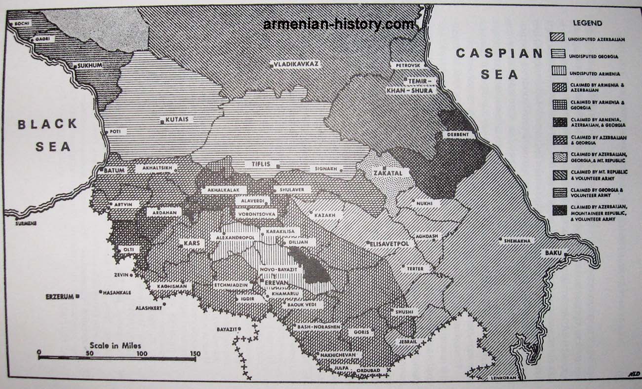
CONFLICT ZONES IN TRANSCAUCASUS
ARMENIAN GENOCIDE IN OTTOMAN EMPIRE (1915-1922) NEW

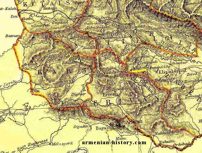
ARMENIAN PROVINCES (KARS AND ERIVAN) – AFTER 1877-1878 RUSSIAN-TURKISH WAR
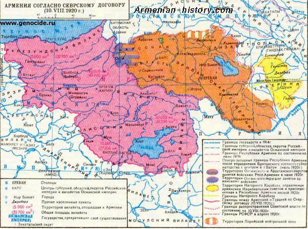
THE MAP OF ARMENIA IN ACCORDANCE WITH SEVR TREATY
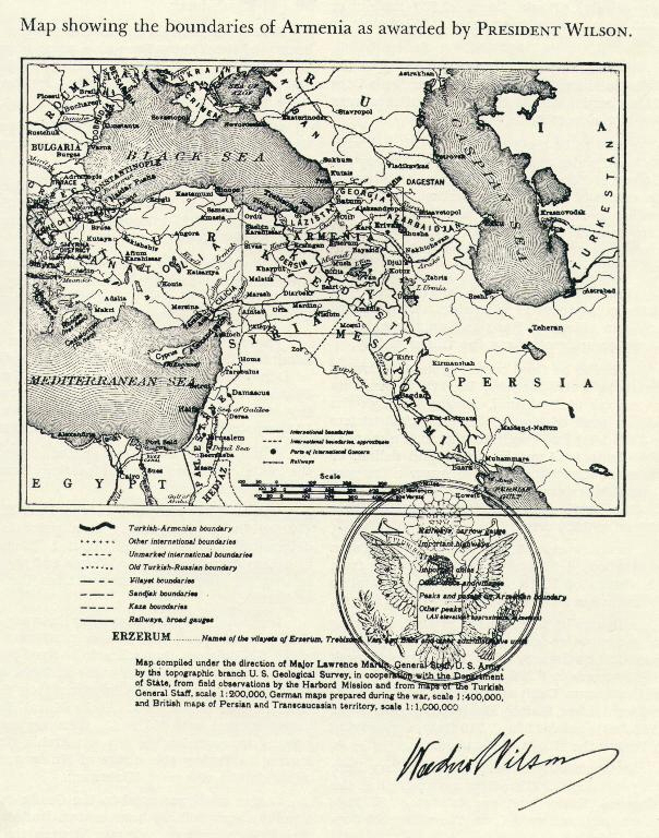
THE MAP SHOWS THE BOUNDARIES OF ARMENIA AS AWARDED BY PRESIDENT WILSON
THE MAP OF SOVIET ARMENIA AND CAUCASUS THE MAP OF SOVIET ARMENIA AND CAUCASUS 1952-1991
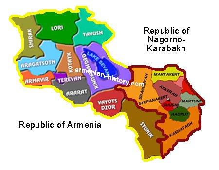
THE MAP OF REPUBLIC OF ARMENIA AND REPUBLIC OF NAGORNO-KARABAKH
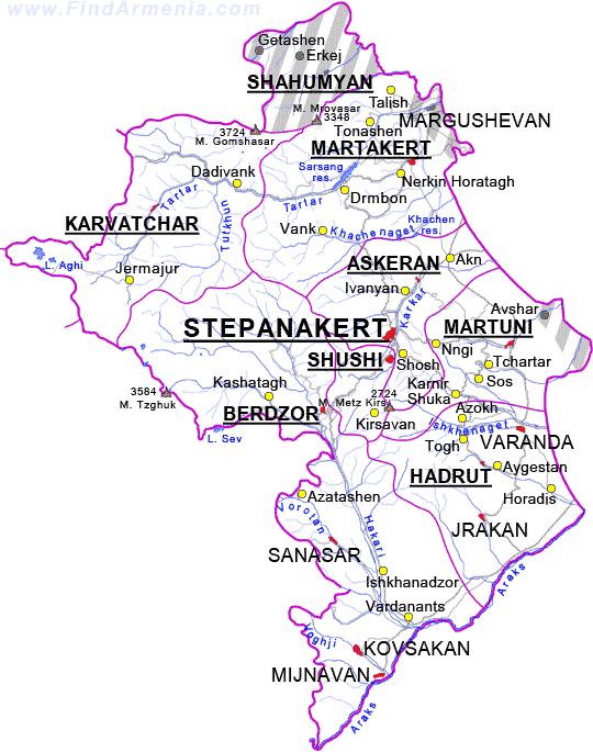
THE MAP OF NAGORNO KARABAKH REPUBLIC – ARTSAKH
THE MAP OF SAMTSKHE-JAVAKHK REGION

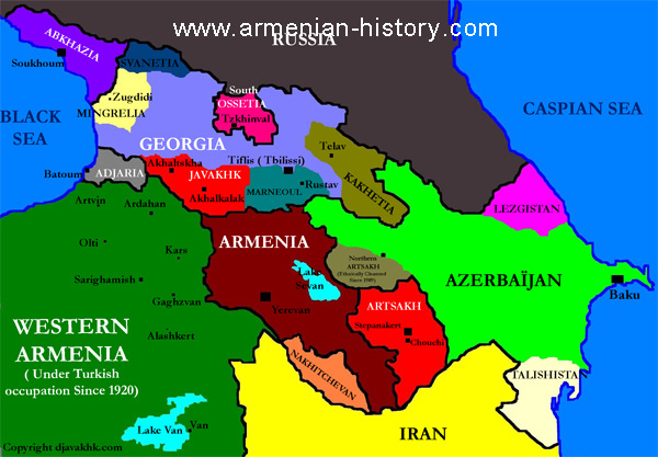
THE MAP OF ETHNIC NATIONS OF TRANSCAUCASUS
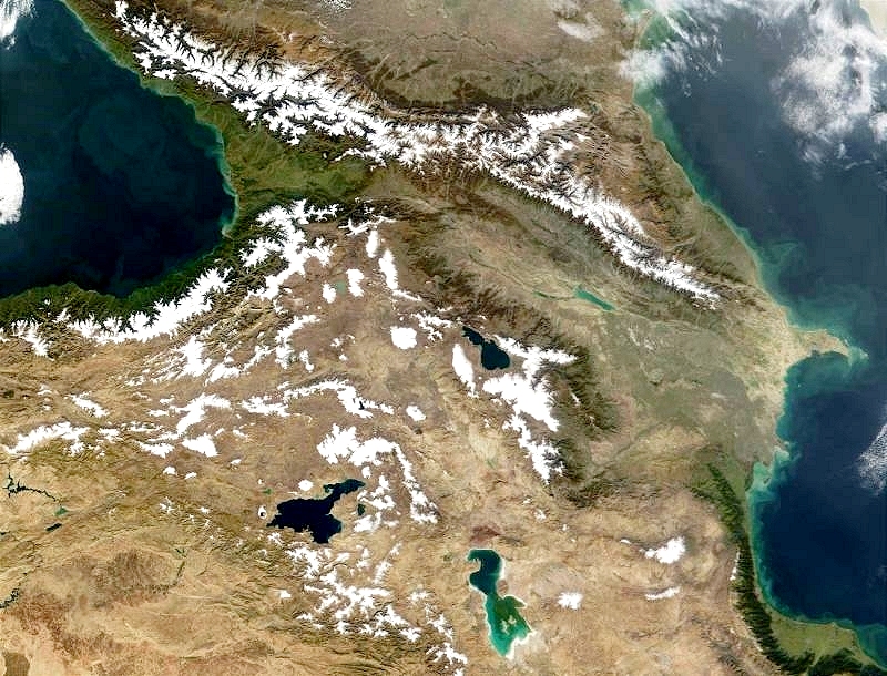
THE MAP OF CAUCASUS (NORTH AND SOUTH) AND WESTERN ARMENIA
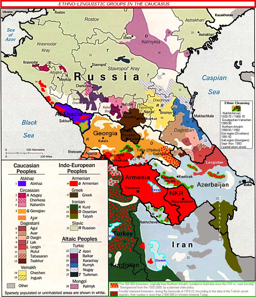
ETHNO-LINGUISTIC GROUPS OF CAUCASUS
Historic and Current Armenia – by Smbat Minasyan